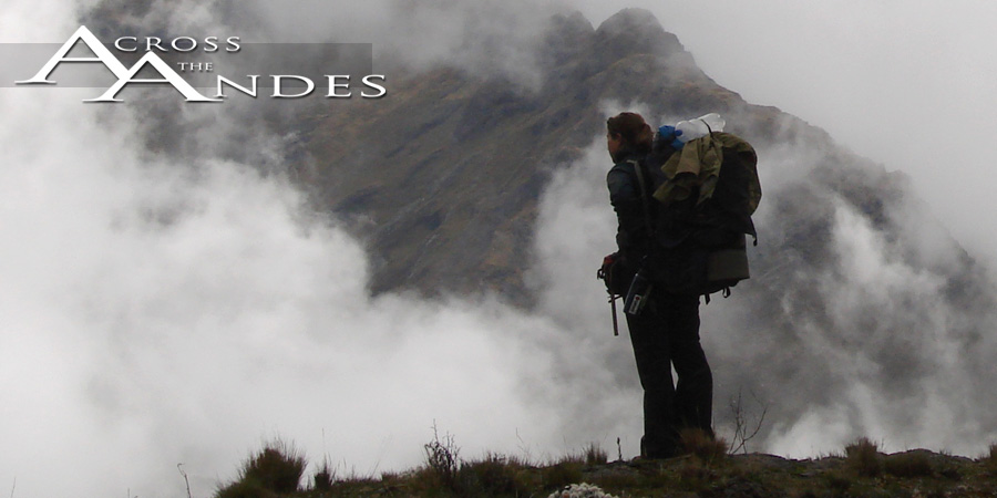


Wrapping Up The North
By Deia Schlosberg
September 11, 2007
Well, that'll do it. For now.
Here I am in Lima, about to get on a plane to New Jersey (via Columbia and Florida). I'm more than excited to be seeing family and friends; I have craved people like never before in my life on this trip. You can crave certain people like you crave specific foods---a pickle or a Snickers bar---Megan, my cousin, and so on. So I'm thrilled to be filling that void so soon. But going back through this last section in my head as I sort through photos here brings all sorts of emotions with it, all bolstered by the quickly upcoming departure from northern South America for an indefinate period of time. Visiting our friends in Huaraz for the past few days further deepened those feelings. Not really regret, not really sadness, but I guess more of a hopeful heaviness that always seems to accompany closing a chapter. Indeed, when we go back to Santiago to finish the hike to the southern tip of the continent, it will be a new chapter, with different cultures, different landscapes and a different mindset. When I walked into Queropalca (where we left off in Peru eight months ago), I think I really understood for the first time that this is only one project in my life, and though it will most likely affect me profoundly every day for the rest of my life, it has an end. I thought I got that when we crossed into Bolivia, but it turns out I didn't.
We began this latest and last-for-now section with a trip to Machu Picchu. We were both a little apprehensive about what it would be like, as in, completely over-touristed and capitalized, but it was something that had to be seen, being a wonder of the world and all. I remembered somewhere in the process of getting there that it had been a dream of mine when I was younger to explore its many levels and chambers. We met our friend Chris, a lone Aussie traveler and generally swell person, in a very cramped combi-ride. The combi was the last leg of a long series of transports to a small town that was a only several-hour hike to the ruins themselves. We had opted out of the touristed train ride to Aguas Calintes (the town at the base of the Machu Picchu site) based entirely on the ridiculous cost of tickets, but it turned out to be a much better experience doing it as roundabout as we did. In fact, it was soon dubbed, "The Perfect Picchu." We arrived late to the small town that our hike would begin from, but the hour did not deter us, and after some food and cerveza, the three of us, plus three Israeli travellers, began the night walk along the tracks to Aguas Calientes. Apparently we were not the only folks with a tight budget, doing the rails on foot rather than butt, as we encountered several other groups along the way. We rested for a few hours in the town that was constructed solely for the purpose of accommodating Machu Picchu visitors, and then the three of us began the series of switchbacks up the steep ridge on which Machu Picchu sits. This portion of the hike was pretty much an uphill-flowing river of foreigners from every corner of the planet; Machu Picchu is very popular. And keep in mind, this portion started at 3:30 in the morning. Once arriving at the road near the top of the ridge and just outside the site itself, we thought we would continue hiking a bit more to see where a small trail through the brush would lead us. Our small trail climbed steeply upward, this time with no switchbacks to assist, and soon the trail itself became difficult to distinguish from other unassigned spaces between plants. We found ourselves climbing roots like ladders and crawling through small, dew-wet spaces wondering if perhaps we had made a wrong turn somewhere. But we kept at it in the grey early-morning hint of coming light. By the time we hit a stone wall and climbed it to emerge on a trail well above the ruins, the sun was nearly up. Being quite disoriented, we pulled the branches out of our hair, dusted ourselves off and waited a moment for a passerby to clue us in as to the needed direction down to the site. We rounded a corner and got our first glimpse. This was a special place. We watched the sunlight spread across the many roofless buildings and the face of Huayna Picchu (the famous peak it's always shown with), and spent the next several hours enjoying exploring. Surprisingly, when all those people from the hike up are distributed over the entire site, it feels relatively empty. It's midday, when the bus-loads start arriving, that the crowded feeling settles in. Also surprising is how open the site is to exploration. Very few areas are roped off, and one is free to wander into whatever chamber one finds most compelling. I reckon this will not be the case in years to come. But as it is now, Machu Picchu turned out to be just lovely.
The next bit on the actual hike took us through the Historical Sanctuary of Machu Picchu for several kilometers. After an unfortunate early-morning encounter with yet another authority wanting to prohibit free walking over land and a subsequent detour, we climbed up and out of the jungley environment we had spent the last week in up to the snowy ridges and peaks around Salkantay. Again, Peru's diversity impresses. The next several days followed this pattern of climbing to windy, and at times snowy, ridges, only to follow with a descent into thick jungle-like forests and hot riverbeds. We calculated that in this week-long section we did 58,000 vertical feet of climbing and dropping. Pretty ridiculous, and definitely the hardest section of the trip so far, at least physically. Toward the end of this week, we passed through Choquequirao, which is getting increasingly popular as "the other Machu Picchu." As of yet, it doesn't really compare, but when you learn that only 30% of the ruins are excavated, and then start noticing all of the terracing and walls buried under the thick vegetation of the surrounding forest, it becomes quite impressive. And here the imagination is more free to come up with explanations to the many questions that arise when walking through the site, as there are no tour guides to eavesdrop on for your possible answers. Despite its recent press, there were certainly no tour groups there, and in fact, by the time we left the site, we had the entire thing to ourselves. I'm curious to see what it looks like 50 years down the road.
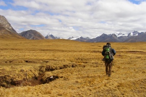
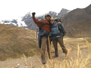
From there, the goal was to walk the Capaq Ñan from Abancay to somewhere around Junin before making our way to the Cordillera Huayhuash where we would finish up. Once we got outside of Abancay, however, we soon realized that our ancient Incan route that we were so hopeful for, had been paved over again and again. Small sections still exist, but nothing long or consistent enough to get anywhere without walking on primary, paved road, with way too much traffic to walk next to. Our next best option for covering ground relatively quickly (and without maps, of course, since they proved nearly impossible to get for anywhere outside of the tourist areas) was to follow the railroad line, but we had to get to it first. The Rio Manflas led us there, winding closer and closer for nearly a week through deserty canyon country. Arrival on the rail line was further postponed by sickness, including Typhoid somewhere in there. Once on the tracks, we made easy mileage, chugging along toward Queropalca and toward our visit home. But what we weren't doing was enjoying the hike. This was not the mountains, this was not what we set out to do, this was walking on a railroad line on the other side of a river from a busy road. So after a few days, we had had enough and decided to leave our easy and assured route and take the risk of going through the mountains without maps. The added stress of lacking our security was more than made up for by the feeling of being up and out and exploring again. We followed high valleys and walked the edges of high, bright aqua mountain lakes. We crossed ridges and dropped to small clusters of houses below where we were welcomed in and given hot tea after thrilling thunder and hail storms. We walked on high plains surrounded by jagged peaks, accompanied by gauchos happy to share a few sips of their rum with us in exchange for the conversation. Soon enough, we were in the shadow of the Huayhuash, a small range geographically, but a phenomenally huge mass of mountain with several peaks over 20,000 ft. (6,000 m). The Huayhuash would, in itself, have been stunning, but adding to its beauty for us was the fact that we had seen it once before from the other side, some eight months earlier; seeing its peaks meant that we had made it. This was the first time either of us allowed ourselves to believe this reality. It took us only an afternoon and the following morning to walk the length of its eastern side, and from there, we had only 7 km down a valley into Queropalca. This last 7 km had a weight to it that I hadn't yet felt. We popped out of a small canyon, and curving along the valley wall the little town came into view. This was the first wave of "oh, wow." that was felt. Walking up to the outside of the town, crossing over the little bridge to enter it, and walking down the street to the plaza where the giant concrete sombrero sat brought the second, much stronger wave. The hat had been floating around in the back of both of our minds ever since we left it last December, knowing that we would see it again after earning our way back from Santiago, step by step. We collapsed in the town square, tears flowing and silent. A woman and her small son watched us from the corner. We had made it. We had come back. We had walked from Quito, Ecuador to Santiago, Chile, through the Andes Mountains. We were two thirds of the way done with the thru-hike, and most of all, I realized that this was really possible.
Through a series of rides we made our way back to Huaraz, our home in South America, where were spent a few days catching up with missed friends and seeing our doctor friend there for one last attempt at curing ourselves. The transition from mountains to small town to medium-sized city to the monstrosity of Lima brought us gradually back into westernized life so that the arrival in the States would not be so shocking. I'm looking forward to what I learn from the differences in culture that I wasn't aware of before. I'm also looking forward to the rest that this month will bring, a chance to get refreshed for the last big push toward the tip of the southernmost walkable (without support) part of the globe.
Thanks to all of our families, our friends and our supporters. This would not be possible without their help.